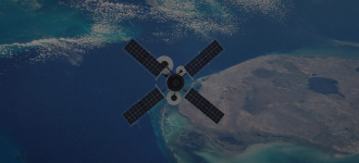
Earth observation cloud‑based software
Project overview
In 2020, we all feel the significant human impact on our planet and profiled establishments seek new ways to stabilize the situation. That’s why the cloud-based software that collects visual information from satellites is in demand. The images can show the facilities’ state, provide access to geospatial and satellite data, and show the state of particular areas. Such solution helps:
- Analyze the consequences of natural disasters;
- Control the situation in the area;
- Compare the old and relevant state.
Business challenge
We needed to provide an easy-to-use and convenient solution to gather visual information in real time and analyze it to observe the Earth. It would help to quickly get relevant information on any required area and control its state. We aimed to enable access to geospatial and satellite capabilities for the most accurate results.
Technical challenges
Cloud-based software helps simplify and automate many underlying tasks and make the work much more manageable. Now, the staff can get statistics and all the necessary information in a few minutes. It helps to compare the state of the area before and after various events such as natural disasters or pollutions.
Solution delivered
In 11 months, DICEUS team has developed a cloud-based solution to observe the Earth with satellites’ images. We aimed to ease the exploring process and get access to geospatial images. The solution helps to quickly get actual information of any area and analyze it according to all the standards. We can get a detailed analysis of any zone and how nature or human processes affected it. It allows making quick comparisons of images of different periods.

Let’s discuss how we can help with your project
Key features
Relevant information
Instant access to petabytes of up-to-date and archive data helps to hold the hand on the actual situation at hand.
Access to images
You can find geospatial images of any scale by selecting the required territory on the map or by its location name.
Analytics
It is easy to get on-the-fly imagery analytics and download any image for business purposes.


